RibAV
Analysis of the distribution of riparian vegetation
RibAV 1D
RibAV 2D
Images
Downloads
RibAV 1D v1.0
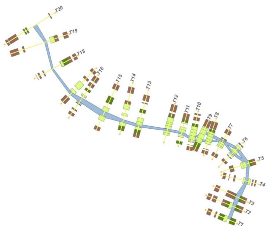
RibAV 1D v1.0 – Model for the zoning of different functional types of riparian vegetation through the calculation of the evapotranspiration index (ETidx) at specific simulation points. This tool allows for the spatial analysis of the zoning of riparian vegetation in response to different hydrological and climatic scenarios at the reach scale.
RibAV 2D v1.0
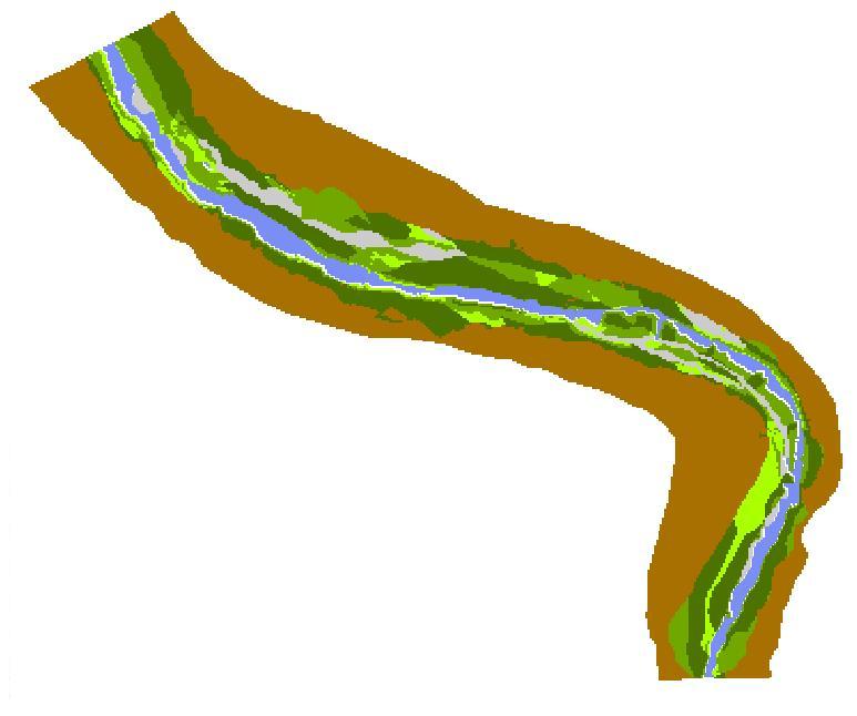
RibAV 2D v1.0 – Model for the zoning of different functional types of riparian vegetation through the calculation of the evapotranspiration index (ETidx) in ASCII maps. This tool allows for the spatial analysis of the zoning of riparian vegetation in response to different hydrological and climatic scenarios at the reach scale.
Images
Downloads
Download - RibAV 1D
Download - RibAV 2D
Our social media
